Monday, September 28, 2009

Google Maps with ads revisited

Last week Sydney Morning Herald published a news item that Google Maps to be plastered with ads. The story is being picked up by online publishers around the world and many are trying to sensationalise the significance of the announcement. However, Google’s foray into advertising on Google Maps is nothing new as the company extends its efforts to provide more and more relevant information to users. Let’s revisit “the story” so far…

The first attempt to bring advertising on Google Map was about 2-3 years ago when Google introduced sponsored markers on both, public version of Google Map and as an optional advertising service available for developers using Google Map API. The ads appeared as little clickable markers when users visited certain geographic areas specified by advertisers. With exception of Japan, this concept didn’t quite catch up. I tested the concept on aus-emaps.com but eventually have given up as hardly any advertisers in Australia bothered to use this form of advertising.

Last year Google introduced an option for developers to add its famous text ads directly on the map to help monetise various mapping applications. The ads can be positioned in a corner of the map and content is dependant on the geographic extents viewed by the users. This follows the concept first introduced by lat49 a Canadian online advertising company attempting to explore map based advertising for Google, Bing and other major online mapping platforms offering APIs for developers. My test results with lat49 ads were less than impressive so, I quickly removed that option from my site. I am yet to try Google version, possibly in the next release of aus-emaps.com front page.


Not many may have noticed that recently Google also introduced clickable mini-markers on its public Google Map site. Things like train or bus stations, museums and other places of significance can now be “clicked on” for additional information. Markers are subtly incorporated into the overall design of the map so they do not detract from map browsing experience. Only when you hover your mouse over those tiny markers you will notice that the mouse pointer style changes to a hand, which means this item is clickable. Extending that concept to branded markers for fast food restaurants or other "commercial" points of interest seems a logical "next step" for Google.


Others are already doing similar things. For example, Telstra has been incorporating branded markers for hotels (roamfree.com and wotif.com), restaurants, petrol stations etc. points of interest on its whereis.com maps for quite a while now and not as subtly as Google. Majority of those points are referenced to Yellow Pages advertisers. For Google, adding those branded markers will be just a small step forward in an ongoing quest to extract maximum value from its asset while providing extra functionality for map users. It is not a “radical new development” that news headlines are inadvertently implying.

Saturday, September 26, 2009

Google for the Australian Public Sector

On September 16, in a private function at Parliament House with Senator Stephen Conroy, Minister for Broadband, Communications and the Digital Economy as a keynote speaker, Google Australia launched a new site “Google for the Public Sector”. As described by Google Australia public policy chief Iarla Flynn, the site is simply “…a guide to the tools and best practice for the public sector to reach, communicate and engage with their communities”.

It was a quiet ceremony (even Senator Conroy’s site does not refer to it officially) and so far there has not been any official directive to consider Google tools as potential solutions in support of Public Sector operations and activities. However, the significance of this event is that it sends a clear message that Google can now be treated as a trusted supplier of competitive technologies. A formal recognition of a kind.

Not that Google didn’t manage to sell its wares to Public Sector before, oh no. For example, Australian Bureau of Statistics uses Google search on its public website and at least a couple of other State and Federal Departments are implementing its commercial GIS solutions. And of course there are occasional Google Map deployments on public sites but overall, penetration of this segment of the market by Google is rather limited. There is no doubt that Google is making an attempt to muscle in on the turf traditionally serviced by Microsoft and its allies. This step in the battle for the market share is aimed at changing perception of Public Servants that Google is not only “that free thing for searching the Internet” but actually a significant technology provider that can offer a whole range of specialised solutions.


To finish off, just a few examples of Google Map applications on Public Sector sites. They may not have a "wow" factor that would make them stand out on the Internet but they well support information content provided on the sites and are a good indication that free resources from Google are certainly being noticed by Public Servants:

NSW Government Stimulus Snapshots Map
Shows where and what projects the $62.9 billion Economic Stimulus package will be spent on.


Renewable Energy Power Stations: Operating and Proposed
Map created by the Department of Environment, Water, Heritage and the Arts depicting locations of power stations by energy source and providing basic technical information about their operations.


Mapping our Anzacs
Mapping tool developed by the National Archives of Australia to browse 375,971 records of persons in the Australian Army during World War I, according to the their place of birth or enlistment.


Australian Indigenous Languages Database (AUSTLANG)
Map created by the Australian Institute of Aboriginal and Torres Strait Islander Studies with information on 1,143 different Indigenous languages and dialects.


Australian places on the World Heritage List
Map created by the Department of Environment, Water, Heritage and the Arts showing 28 World Heritage listed locations with links to more extensive information about each place.

Thursday, September 24, 2009

Ban on use of phone GPS navigation in cars

The story of mobile phones turning into fully featured GPS navigation devices is taking an unexpected twist. It appears that some authorities in Australia are planning to ban the use of such devices in cars – based on a simple principle that these are still “only” mobile phones and as such cannot be used legally “while driving”. The Age reported on Monday that the Victorian Government road traffic authority VicRoads will introduce a new amendment to the road rules, taking effect November 9.

However, the ban will not apply if your GPS navigation enabled phone is placed in purpose-made cradles and operation is entirely hands-free. But be aware, it will not get you off the hook if you are a Learner or P-plate driver! In Victoria Learner and P1 drivers, are not permitted to use a mobile phone at all while driving.

Cheap navigation option …
[image courtesy of http://xkcd.com/ as first spotted on http://googlemapsmania.blogspot.com]

If you have already bought your Tom Tom, Navigon or similar application for mobile phone you will need to budget a bit extra for a proper holder. The law in other States is unclear at this stage however, prevailing attitude is that "…if it's a phone, it's a phone". So, you can be fined for holding it on your lap or in your hand while driving. Since hands-free use of phones is permitted in Australia, invest in adequate accessories to take full advantage of GPS navigation capabilities of your mobile phone and of course to be on the safe side regarding laws governing use of mobile phones in cars. Suddenly the price gap between mobile phone enabled navigation applications and purpose built GPS navigation devices got smaller…

Wednesday, September 23, 2009

Dust storm turns Sydney red

Today the biggest item on the news is a dust storm over Sydney. Visibility was reduced almost to 0 as a big cloud of red dust totally blanketed the city. I have compiled a short list of videos from YouTube so you can get the feel for what it was like… Sydney dust storm captured on videos.

Yesterday it was Canberra that looked a bit red-ish (the sky and anything on the ground) but conditions were not as severe. Overnight rain washed away the dirt so now the city is “as new” again. This image from NASA shows the dust cloud over Eastern Australia yesterday (from MODIS Aqua captured at 13:40 AEST 22/09/2009). You can see in top left corner what “hit” Sydney today…


Tuesday, September 15, 2009

Live traffic on Google Map Australia

Today Google launched yet another service to complement Google Maps and Google Maps for Mobile: live traffic information for major cities and regional centres. Traffic congestion indicators are currently available for major and minor arterial routes in Sydney, Melbourne, Brisbane, Wollongong, the Central Coast, Geelong, the Sunshine Coast and the Gold Coast.


To display traffic information on Google Map simply click on the button labelled 'Traffic' and a colourful mesh of lines will be overlayed on the base map. Red lines indicate congested routes and green lines depict streets with free flowing traffic.


Google also offers an option to view traffic conditions at different times of the day and on different days of the week. The data is predicted based on past conditions and is not an indication of what exactly was the traffic situation eg. “last Monday”. To access this functionality just click “change” option on the traffic legend.

It is quite interesting how Google generates the information in real time. In particular, it is derived by “crowdsourcing”. That is, Google collects information from people who have Google Maps for mobile running on their GPS enabled phones and who have chosen to enable ‘My Location’ service. As they drive along city streets the phone sends anonymous bits of data back to Google about how fast the device is moving. By combining that anonymous speed data from thousands of mobile devices travelling on the roads Google can compute live traffic conditions and generate Google Maps traffic layer. The more people that participate the more accurate the information. Google is very strong on enforcing privacy protection measures so the information is collected only from people who choose to participate and is totally anonymous.

With the release of traffic information service for Australian largest cities there is an opportunity for a great improvement to Google’s driving directions service: adding an option to “avoid congested roads”. It would nicely complement “Avoid highways” and “Avoid tolls” already available as additional filters for defining the most appropriate route.

Monday, September 14, 2009

Manual geocoder for 70 countries

Google provides a number of complementary services to support advanced functionality of Google Map. Address geocoding is one such handy service. It facilitates finding geographic coordinates for addresses, locations, postal areas and geographic features in 70 countries around the world (208 in total if countries with partial geocoding capability are included - as at September 2009).

Although the primary use of geocoding service in Google Map is for depicting points of interest based on commonly known names (address, locality etc.) and/or for specifying “To” and “From” locations for driving directions service, the underlying functionality can also be used for extracting geographic coordinates of those locations for other purposes. For example, you may need geographic coordinates of your business venues (like shops, offices, meeting places, etc) to depict them on a static reference map for your web site or corporate brochure.

Simple Geocoder is a free service provided by aus-emaps.com to assist in extracting geographic coordinates of points of interest. The points can be identified either by their name (eg full address, town, postal area) or simply by clicking on the map.


Use “Address” tab to search for locations based on their name. As mentioned above, it could be a full address, or just suburb/ town name, postal area code or a prominent geographic feature. If found, the location will be marked on the map and the following information about the location will be printed under the text input box:

  • correct address and/or full details about the location, exactly as in Google database, as well as its latitude and longitude coordinates;

  • comments field will provide description as to the accuracy of geocoding process (see below for description of codes).
    Accuracy Code Descriptions:

    0 - Unknown location.
    1 - Country level accuracy.
    2 - Region (state, province, prefecture, etc.) level accuracy.
    3 - Sub-region (county, municipality, etc.) level accuracy.
    4 - Town (city, village) level accuracy.
    5 - Post code (zip code) level accuracy.
    6 - Street level accuracy.
    7 - Intersection level accuracy.
    8 - Address level accuracy.
    9 - Premise (building name, property name, shopping center, etc.) level accuracy.
Handy tips:

  • click on location description text to zoom to that particular place on the map

  • you can manually reposition the marker with a mouse if it is not in the right spot (left button click-hold-drag function) and geographic coordinates in the description text will be adjusted accordingly;

  • you can execute multiple searches (one at a time) and then copy the information to other documents “in one go” by highlighting the text and copying it with right-mouse-button-click function.


Use “Point” tab to geocode locations by clicking on desired points on the map. This function is very handy for creating vertices for polylines and polygons or where text search described above is not yielding adequate results. Position of markers can be adjusted by dragging them on the map and geographic coordinates text will be adjusted accordingly.


Bulk geocoder function is no longer available for free use due to changes in Google service terms and conditions, aimed at protecting commercial suppliers of address data. However, Simple Geocoder will be sufficient for gocoding tasks where small to medium volume of data is involved.

Sunday, September 13, 2009

Free Australian weather widget

It is time to launch another web widget: live weather information for 196 localities in Australia. It is free to use for any website - all I ask for is just tell others about it! Information is coming from the Australian Bureau of Meteorology (BOM) every half an hour so, it is official weather data. Currently, there are four display options:

  • current temperature and today’s forecast for all capital cities (default view);
  • current observations for a specific location (temp, dew point, barometric pressure, humidity, visibility and rain since 9am);
  • graph displaying temperature changes in the last 24 hrs (min, max and current temperatures are marked for information);
  • 7 day forecast for a given location (shorter forecasts for minor localities).

Visitors have the ability to check weather information for specific towns or localities by typing the name of location of interest in the input box. Auto look-up function shows matching names as text is typed in.


The widget can be embedded in any website with a simple line of code and there is an option to set the city, info tab and top bar colour to suite your requirements. Full setup instruction is provided on aus-emaps.com site.

This is the second weather widget that I am sharing with others through my aus-emaps.com site. The fist one, build with free service provided by weatherzone.com.au, was released in 2006 and was part of aus-emaps.com front page design since day one. I will maintain it indefinitely for anyone interested but the future development will focus on my new creation.

Briefly about the new widget, from a technical point of view. I have already been using BOM’s Web Feature Service for my weather map, snow map for NSW and snow map for Victoria so, when I decided to update the widget, it was easy decision as to the source of the data. On the back end, I use CRON jobs to call BOM service at regular intervals and PHP script to convert weather information (current temperature and forecasts), delivered in XML format, to MySQL database. Matching weather stations with localities was a bit of a challenge since “forecast locations” do not relate directly to “weather station names”.

The front end is built with jQuery JavaScript library and auto look-up extension. It was the only way to provide “links” to 196 locations in such a confined space. Temperature graph was a late addition but I believe it was worth the effort. Complexity of generating the graph using Google Chart service is not trivial but it was either this approach or using PHP GD image processing library. Managing “time” for multiple time zones was another challenge – so, until I come up with something better, time displayed in the widget will always refer to user local time (derived from computer's internal clock).


Your comments and suggestions for improvements, as usual, most welcome!

Monday, September 7, 2009

Post code maps and population statistics

Post Codes were introduced in Australia in 1967. What was initially only a tool to improve efficiency of distribution of mail has now become a very versatile “point of reference”, with many different applications. For example, a lot of important information is published “by postcode area” (like real estate sales, social trends, demographic statistics, etc.), very often franchise or sales territories are defined based on post code extents and now even street gangs started using post codes to define their territories of influence and post code numbers became the symbols of their allegiance!

In Australia postal codes are usually assigned to geographical areas (eg. suburb or town) but they are not always contiguous areas and quite often have complex geography, especially in areas beyond the urban fringe, and tend to change over time. Post codes can also relate to individual addresses or to institutions that receive large volumes of mail, such as government agencies and large commercial companies. Australia Post maintains the most up-to-date database of post codes with detailed references to localities. Postal boundaries data published by Australian Bureau of Statistics (ABS) are updated at every population Census (the last one was in 2006).

There are certain caveats that need to be considered in more advanced use of post code information which I will cover in more details in a separate post. Today I just wanted to introduce a simple tool offered by aus-emaps.com and called Postcode Finder. It can be very handy, not only for private individuals but also for business, as it allows to:

  • locate postcodes and view their geographic extents;
  • find locations and determine which postcodes they belong to;
  • create and print maps of postal areas and suburbs/localities contained within.

Please note, due to limitations of Google Map, printing is only possible in Internet Explorer. Click “about” link on Postcode Finder page for important information on printing.

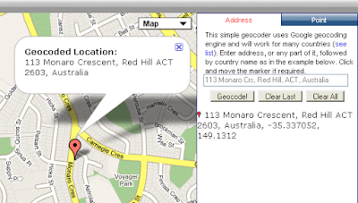
Postcode Finder supports text based search via input boxes located in the top left corner of the page. The first one is for searching by post code number and the second is for searching localities.


If search was successful, a location will be marked on the map and an information window will display a range of options for adding post code and suburb boundary overlays with respective labels.


If you were searching using post code number, “Ref-map” tab will contain an image showing full extent of a given postal area (depicted here on the right). The image can be copied to your electronic documents using "right mouse button click" function.
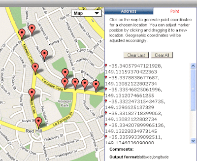
An alternative postcode search option is via a click on the map. It will initiate a search action for a post code that covers that exact geographic location. Please note, water bodies have no assigned post codes however, click on any other area on the map should return a valid response (try again if you are not successful!).


Background map in Postcode Finder can be changed between street directory, satellite image (with or without street overlay) or terrain map to suit your requirements.


Postcode Finder supports “link to map” functionality which you can use to bookmark locations of interest with a specific background map option. To view boundary outlines just click on the map and select required layer from the options in the "pop-up balloon" that will appear.


Special Feature: Demographic Information for Postal Areas

A distinctive feature of Postcode Finder is a list of links to demographic information from Australian Bureau of Statistics (ABS).


Summary statistics” link will take you to a page with a brief overview of main population statistics for the area. “
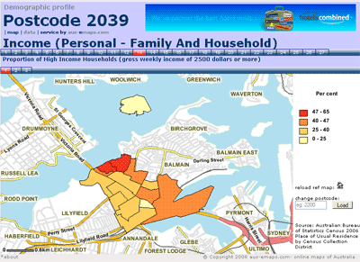
Thematic maps” will show distribution of population within a postal area according to certain characteristic like income, profession, employment status, etc. (as shown on the map on the right - click it to view live page). “Detailed data” link will take you to a page where you can select and download information as Microsoft Excel files. Functionality of the last two pages is very similar: just click on the first row of numbers to select the topic of interest and on the second to select specific data item. And both pages can be linked to directly from any web site or electronic document (click "about" link under the map for full instructions). For example, to link to Thematic Maps page use the following URL: http://www.aus-emaps.com/postcode_demographic_profile_map.php?pc=2000 [substitute "2000" with a postcode of interest].


This resource is a very handy research tool. Demographic profiles for postcodes can greatly assist in strategic planning and marketing of consumer goods and services. They are also very handy in real estate when assessing properties for purchase or investment. There are over 90 thematic maps and 248 detailed data tables for each individual post code. All free for your perusal, without the need to sign up to use the service.


Related post:
Sales Area Management Tool with Postcodes 
Map of Australian Postcodes 
State postcode maps  
Free postcode search widget 

Sunday, September 6, 2009

More unique features of Australia discovered

Some weekend trivia :-) ... Last week several stories circulated about the discovery of the coldest place on Earth - which happens to be in Australia (or more precisely, in the Australian Antarctic Territory). This week the "main story" is flash eating plant! All who have ever been to Australia, or live here, know pretty well that this is a unique and remarkable country, in many respects, but THIS sounds like pure science-fiction!


The flesh-eating pitcher plant (Nepenthes tenax ) was found on northern Cape York. It can grow a maximum height of 100 cm and potentially can eat small rats, lizards and birds. It was highlighted by WWF Australia (used to be World Wildlife Found) as an example of "the amazing richness of Australian biodiversity". The study by WWF Australia found that, on average, two new species have been discovered in this country every week during the last decade and that potentially there are 1000's more to be discovered. Who knows what else may be lurking deep in the bush. One more danger to be added to my advice to travelers visiting Australia!

But seriously, the key message of course is to focus on the protection of what we've got! According to WWF Australia, there are currently 125 species critically endangered in this country so, engage to save our fauna and flora while it is still not too late! Here is a link to WWF Australia "Australia's hidden treasures" report.

Saturday, September 5, 2009

Embed web pages in PowerPoint

Have you ever given a public presentation where you had to jump between your PowerPoint slides and live web pages? Wouldn’t it be nice to be able to display web content within the PowerPoint presentation?

Or what if you need to compare two applications and displaying them on one screen would make it easy to demonstrate subtle differences? Or how about setting up “a mobile operations room/ command centre on a budget”, with only one projector and one computer to display multiple information windows?

There is a trick to accomplish all of that and impress your audience. You don’t have to be technically savvy but it requires some preparation and a simple procedure to deploy your presentation every time you are using someone else’s equipment.


Here is what to do:

1. Visit this site http://skp.mvps.org/liveweb.htm and follow instructions! Very easy :-)

All steps are very well described there so, rather than rewriting the instructions, I will just share with you a few tips from my experience:

  • Download both files from the page referenced above to accommodate various versions of PowerPoint as you never know which version will be available to you when presenting “on the road”.
  • Please remember that your embedded HTML pages will only work if there is a plug-in installed. For all practical purposes, always have two versions of your presentation (with and without embedded HTML).
  • Have a printed installation instruction sheet handy for quick reference (and possibly, write your own!) since sometimes it is easy to miss a step when installing plug-in “under pressure”.
  • Make sure you have reliable access to Internet when you choose to run embedded HTML version of your presentation (otherwise there will be no content!).
  • I strongly suggest to disable standard PowerPoint controls (like mouse-click to move to the next page or mouse-wheel functions) otherwise navigation between HTML content and PowerPoint slides can be a bit tricky. [From menu select: Slide Show | Set Up Show… and then “Browsed at a kiosk (full screen)” option.] However this will necessitate creation of custom navigation controls on each page (which is best accomplished in one go via slide master), otherwise there will be no way of moving from page to page during your presentation.
  • Last but not least, since this is Microsoft application, you need pretty powerful computer to run this set up and since PowerPoint uses web object, not a "real browser", some pages may not display correctly (especially those using fancy javascript stuff).

Have fun and good luck!

Wednesday, September 2, 2009

Science proves Australia coldest place on Earth

Would you believe that? It probably comes as no surprise to many overseas visitors. You often hear comments like “I have never been so cold in my life as here in Australia!” And these are comments even from those used to harsh Northern Hemisphere winters. I don’t know, maybe it is a reflection on how depressing winter can be in Canberra or maybe it is because of a common perception that “Australia is such a warm and sunny place” (this is how Australia is normally portrayed in travel brochures) that the idea of snow and ski fields in this country is difficult to reconcile for some.


Now there is a "scientific proof" that one of the coldest places on Earth is in Australia, technically speaking… It is a place called Ridge A, located in the Australian Antarctic Territory (81.5 °S 73.5 ÂșE), where winter temperatures do not get much warmer than -70 degrees Celsius. It is an unusually calm place and is situated at 4,000 m above the sea level.


The place was identified using satellite imagery and climate models as part of a study conducted by a team of astronomers at the University of New South Wales to locate an ideal spot on Earth for the ground based optical telescope. They have concluded thatRidge A looks to be significantly better than elsewhere on the Antarctic Plateau and far superior to the best existing observatories on high mountain tops in Hawaii and Chile.” Never mind the cold!

Tuesday, September 1, 2009

What every treveler to Australia should know

A few points of advice to every tourist travelling Down Under:

Our wilderness is vast and pristine but it can be harsh and you can get lost easily
- tell others (eg. friends, hotel receptionist) where you are going and when you will be back (and don't change plans in the last moment!);
- always have a mobile with you but coverage can be limited so better, buy emergency beacon;
- never leave your car when you break down in the middle of nowhere;
- always carry plenty of water;
- learn basic road rules before venturing into the wilderness, driving conditions are very different in the outback.

Our beaches are the most beautiful in the world but can also be deadly
- avoid swimming on unpatrolled beaches, there are dangerous currents (rips) and if you are not aware of their existence, they can turn your happy day at the beach into a very sad experience.
- if you ever get caught in a rip don't try to swim towards the shore, even if you seem to be only "5 meters away” from it! Your physical strength is no match for the current. Swim along the beach and you will quickly escape the force of the rip as they are only narrow corridors of strong currents.
- raise a hand if you need to alert others you are in trouble.

Our fauna is unique and rich – enjoy the experience but be aware of dangers
- avoid swimming at dawn and dusk not to tempt sharks to attack;
- don’t go into water if you spot any jellyfish and stingers, check with locals whether it is safe;
- while in northern part of Australia, avoid proximity to lakes and rivers, especially after dark, not to tempt crocks to attack;
- wear long boots to the bush and never handle snakes, some are very deadly;
- avoid walking bare foot on the grass (Sydney and NSW only), Funnel Web spider bite can be deadly if not treated immediately;
- when handling metal objects that are left outside (chairs, ladders, metal scrap) watch out for Red Back spiders, their bite can make you very sick;
- always respect the wilderness and you will have wonderful holidays in Australia!